


If you canoe in Ontario, you are likely to use portages to get you around obstacles, and you may wonder whether you are allowed to use them. As a rule of thumb, on public land which includes the Provincial and National Parks, you are free to proceed. On private land, ask for permission.
The Ontario Public Lands Act (March 31, 1997), Chapter P43, Item 65(4) defines the Public's right to portage:"Where public lands over which a portage has existed or exists have been heretofore or are hereafter sold or otherwise disposed of..., any person traveling on waters connected by the portage has the right to pass over and along the portage with the person's effects without the permission of or a payment to the owner of the lands, and any person who obstructs, hinders, delays or interferes with the exercise of such right of passage is guilty of an offence..." Ontario Supreme Court Ruling on the Reed dam of the Credit River, at Norval: the right to portage is denied because a dam was built where there was no portage before. Tough, eh? So, stand up to anyone trying to build a dam across your favorite river! Ruling of Hosaic Creek, in eastern Ontario, as being a navigable waterway. You gotta share with hunters, though. Lots of legalese, but also some neat statement of the use of Ontario's creeks by Iroquois natives. Ruling on Bronte Creek, west of Toronto, as being navigable. There are many references to other legal cases, including some of the US references
Many thanks to Jim Greenacre for giving me the ugly details of the Credit River case, and to Richard Culpeper for making proper legal search documents available.
**********************************************************************************************************************************************************************************************************************************
Ontario Supreme Court Ruling on the Right to Portage
Summary:
The individual defendants owned a farm through which a river ran. The farm had been granted by the Crown in two parcels in 1821 and 1822, but the Crown patents did not grant title to the river bed. Prior to the grants, the river had been used by Indians and explorers for canoeing and trading and it was probably also used to float logs to sawmills. In 1825, a dam was built across the river at about the mid-point of the farm. It was still used by the individual defendants to generate electricity. The defendants erected fences across the river each spring to contain their cattle and took them down in the fall. The fences proved to be an obstruction to the plaintiffs, who were recreational canoeists. Further, the canoeists used the defendants' farm as a portage to get around the dam. They brought an action for a declaration that the river was navigable, that the defendants did not own the bed of the river, and that they could not obstruct navigation by means of fencing. The plaintiffs also sought a declaration that they had a right of portage around the dam over the defendants' farm. The plaintiffs added the Attorney-General as a party defendant.
Held, the river was navigable and the defendants did not own the bed, but the plaintiffs did not have a right of portage.
Having regard to the history of the use of the river, it was clearly navigable. It does not have to be used solely for commercial purposes in order to be navigable. Nor did it matter that it became unnavigable during the summer months. That being the case, the defendants did not own the river bed, both because it had not been granted to their predecessors in title and because s. 1 of the Beds of Navigable Waters Act, R.S.O. 1980, c. 40, reserves the bed to the Crown. It followed that the defendants could not obstruct navigation by means of fencing as they had done. However, they could fence the river to contain their cattle, so long as they provided a means of access to the river through their property for canoeists, by providing a gate or other device. On the other hand, the right to use a navigable river does not imply a right of portage over private property, such as the defendants' farm. In any event, the court could not grant such an ill-defined way and subject the defendants to possible liability for its use.
Canoe Ontario et al. v. Reed et al.
Indexed as: Canoe Ontario v. Reed (H.C.J.)
69 O.R. (2d) 494 [1989] O.J. No. 1293 Action No. 20126/87
ONTARIO High Court of Justice Doherty J.
July 31, 1989.
Natural resources ? Water and watercourses ? Navigation ? Canoeists seeking declaration that river running through property navigable and owners of land not owners of bed ? Not entitled to obstruct passage ? River always navigable ? Declaration to be granted ? Canoeists not entitled to declaration of right of portage around dam ? Bedsof Navigable Waters Act, R.S.O. 1980, c. 40, s. 1.
Re Coleman and A.-G. Ont. (1983), 143 D.L.R. (3d) 608, 27 R.P.R. 107, folld
Iveagh v. Martin, [1961] Q.B. 232; Ne-Bo-Shone Ass'n v. Hogarth, 7 F. Supp. 885 (1934); affd 81 F. Supp. 70; Lyon v. Fishmongers' Co. (1876), 1 App. Cas. 662; Marshall v. Ulleswater Steam Navigation Co. (1871), L.R. 7 Q.B. 166, apld
Other cases referred to
R. v. Moss (1896), 26 S.C.R. 322; Rainy River Navigation Co. v. Watrous Island Boom Co. (1914), 6 O.W.N. 537; Stephens v. MacMillan, [1954] O.R. 133, [1954] 2 D.L.R. 135; A.-G. Que. v. Fraser (1906), 37 S.C.R. 577; affd [1911] A.C. 489 sub nom. Wyatt v. A.-G. Que.; Fort George Lumber Co. v. Grand Trunk Pacific R. Co. (1915), 24 D.L.R. 527, 32 W.L.R. 309; Gordon v. Hall, [1958] O.W.N. 417, 16 D.L.R. (2d) 379; Welsh v. Marantette (1983), 44 O.R. (2d) 137, 3 D.L.R. (4th) 401, 27 C.C.L.T. 113, 30 R.P.R. 111; affd 52 O.R. (2d) 37, 21 D.L.R. (4th) 276, 33 C.C.L.T., 289, 36 R.P.R. 236; leave to appeal to S.C.C. refused 54 O.R. (2d) 800n, 29 D.L.R. (4th) 160n, 65 N.R. 159n; A.G. Quebec v. Mireault (1987), 46 R.P.R. 95; U.S.A. v. State of Utah, 283 U.S. 64 (1931), Harrison v. Fite, 148 F. 781 (1906); Gann v. Free Fishers of Whitsable (1865), 11 H.L.C. 192, 11 E.R. 1305; R. v. Robertson (1882), 6 S.C.R. 52; McNeil v. Jones (1894), 26 N.S.R. 299; Rice Lake Fir Co. Ltd. v. McAllister (1925), 56 O.L.R. 440, [1925] 2 D.L.R. 506; Wood v. Esson (1883), 9 S.C.R. 239
Statutes referred to
Beds of Navigable Waters Act, R.S.O. 1980, c. 40, s. 1
Public Lands Act, R.S.O. 1980, c. 413, s. 62(4)
ACTION for a declaration that a river was a navigable waterway, that the defendants did not own the bed and could not obstruct navigation, and that the plaintiffs owned a right of portage over the defendants' lands.
Robert Hickman, for plaintiffs.
E.W. Greenslade, for defendants.
S. Mason, for Attorney-General of Ontario.
DOHERTY J.:?
I The issues
In this case, the interests of the plaintiffs ("the canoeists") collide with those of the defendants, Julian Reed and Laurie Reed ("the Reeds"). The collision occurs along the stretch of the Credit River which runs through the property owned by the Reeds ("the property"). There are three issues:
(i) Do the canoeists have any right to canoe along the part of the river which passes through the Reeds' property?
(ii) If the canoeists have that right, do they have the right to demand the removal of the temporary barriers constructed across the river by the Reeds?
(iii) If the canoeists have that right, do they have the right to enter upon the Reeds' property in order to portage around a dam built in 1825 and presently used and owned by the Reeds?
I must decide to what extent, if at all, the Reeds' interest in maintaining the privacy of their home, and the effective operation of their farm must yield to the interests of those who wish the satisfaction and pleasure of canoeing along this scenic part of the river.
II The scene
The Reeds own a 100-acre farm just west of the Town of Norval, Ontario. Norval is situated east of Georgetown, Ontario, on Highway No. 7. The property on which the farm is located was originally sold by the Crown in two parts: the first in 1821, and the second in 1822. For present purposes, the grants can be taken as being identical. Robert Noble, Mr. Reed's maternal great-grandfather, purchased the property in 1868 and operated the farm and a mill for many years. The property fell out of the family's ownership for several years but was subsequently re-acquired by Mr. Reed and his mother.Mr. Reed has lived on the property all of his life and has owned all or part of the property for over 25 years.
The river travels through the property in a north to south direction. The exact course of the river varies somewhat from year to year. The property is located on both sides of the river for a distance of about one and one-quarter miles. Mr. Reed grazes his cattle on both sides of the river and from time to time, it is necessary for him to take his cattle across the river.
In about 1825 a dam was built across the river at about the mid-point of the property. Just upstream from the dam a pond developed. That pond varies in size, shape and depth from year to year and from season to season. On occasion, parts of the pond area will be dry. A bridge crosses the river on the property south of the dam. Every spring, Mr. Reed strings barbed wire fences across the river in order to keep his cattle from wandering up or down the river when crossing the river. One of the barbed wire fences runs across the river just north of the bridge but south of the dam. The other fence is strung across the most northerly boundary of the property. These fences are removed every fall and replaced in the spring. Both fences obstruct anyone attempting to canoe along this part of the river. In addition, canoeists wishing to travel the entire length of the river which passes through the property must portage around the dam. The most convenient portage takes them across the property. The Reeds consider those who take thisportage to be trespassers and have posted appropriate signs.
III The parties and these proceedings
Canoe Ontario is a non-profit corporation composed of a number of groups with a mutual interest in canoeing in Ontario. Mr. Greenacre is a canoeist who has canoed on the part of the river which passes through the Reed property, and wishes to do so in the future. The canoeists' standing has not been challenged by the Reeds.
The Reeds own and operate the farm described above. In opposing the canoeists' application, the Reeds are not motivated by petty selfishness. They live on this property and it is their firm belief that some of those individuals who choose to recreate along the river do not pay proper heed to the needs of those who live and work on the property adjoining the river. I accept Mr. Reed's evidence that his fences have been damaged, garbage has been left on his property, and on occasion, his family has been verbally abused by a small minority of those who use the river for recreational purposes. I am completely satisfied that the Reeds take the position that they do in a genuine effort to preserve the use and enjoyment of their home and farm.
I must also stress that there is no suggestion that Mr. Greenacre or anyone affiliated with Canoe Ontario has engaged in the discourteous and disorderly conduct described by Mr. Reed.
The Attorney-General was joined as a defendant because of his potential interest in the issues to be determined. He has taken no position in the litigation save to support the canoeists' contention with respect to the approach to be taken in defining the phrase "navigable waterway".
On the trial of the issue before me, the parties adduced evidence in the form of a joint document brief and certain videotapes. It was agreed that I could receive all of this material as evidence. It was also agreed that, with certain specified exceptions, the facts referred to in the material should be accepted by me as proved. In addition to the document brief and the videotapes, several affidavits were filed by the canoeists with the consent of the Reeds. Mr. Reed also testified.
IV The position of the parties
The Reeds contend that the part of the river which runs through their property is not a navigable waterway and that they own the riverbed by virtue of the terms of the original Crown grants. They say they are entitled to exercise control over access to that part of the river, and to construct fences, complete with fence posts sunk into the riverbed, across the river.
The canoeists assert that they are entitled to canoe along the river because it is a navigable waterway and is not subject to any proprietary interest on the part of the Reeds. The canoeists contend that the Reeds have improperly obstructed their right to navigate the river by the erection of the fences. They also argue that as the Reeds choose to keep and use the dam which is situated across the river, they are obligated to allow the canoeists reasonable access to their property so as to permit them to portage around the dam.
V Is the river a navigable waterway?
This case turns on whether the part of the river which passes through the Reeds' property is a "navigable waterway". The Reeds only have a proprietary interest over the river and its bed if the river is not a navigable waterway. This is so for two reasons. First, the Crown grants, which are the root of the Reeds' proprietary claim, reserve to the Crown all rights in all navigable waterways which pass within the lands. If the part of the river which passes through the Reeds' property is navigable, then title to the riverbed did not flow with the Crown grants. Secondly, s. 1 of the Beds of Navigable Waters Act, R.S.O. 1980, c. 40 provides:
1. Where land that borders on a navigable body of water or stream, or on which the whole or a part of a navigable body of water or stream is situate, or through which a navigable body of water or stream flows, has been heretofore or is hereafter granted by the Crown, it shall be deemed, in the absence of an express grant of it, that the bed of such body of water was not intended to pass and did not pass to the grantee.
Subject to certain exceptions which are not applicable here, the Act applies to land which was granted prior to its enactment. If the river is navigable, then this Act provides that the Reeds have no proprietary interest in the riverbed since the grants did not expressly grant the riverbed to their predecessors.
To determine whether the part of the river which passes through the Reeds' property is a navigable waterway, I must first review the historical information provided to me. By the latter part of the eighteenth century, the river served as a meeting ground for French traders and local Indians. Both travelled at least part of the river for trading purposes. By the turn of the nineteenth century, most of the river was reserved for the use of the Mississauga Indians. The land demands caused by immigration from the United States following the War of 1812 led to the surveying of lands adjoining the river, and to settlement along the river. In 1820, the Mississauga Indians gave up their rights to exclusive use of the river. During the next 30 years, the river was a focal point for a variety of commercial activities. Several dams were built to supply power for the flour mills, saw mills, and other enterprises which thrived along the river.
There is some indication that during the first part of the nineteenth century, logs for the saw mills were floated down various parts of the river. Apart from the logging business, it does not appear that the river was used for commercial traffic during this period of significant commercial development. The early proliferation of dams along the river, combined with the quick development of an effective system of roads, precluded the use of the river as a means of commercial transportation.
By the early part of the twentieth century, the commercial activity along the river had subsided. Gradually the dams fell into desuetude. Today, only the dam on the Reeds' property, which is used to generate electricity for the Reeds' personal needs, serves any functional purpose. All but one or two of the other dams have been removed either by nature of by man.
Apart from commercial activity, the river has been the focal point of various recreational pursuits over the years. At least two references to the use of the river for recreational canoeing are found in the material provided to me. In the brochure entitled "The History of the Credit River", the author writes:
Since the 1920's the Credit has been used extensively for recreational purposes. Canoeists have used the river in spring and summer months and snowmobilers have used it during the winter.
The brochure does not indicate what part of the river is being referred to in the extract quoted above.
A second brochure entitled "The Credit: Canoeing in Suburbia" contains the following passage:
For canoeists, the Credit is a springtime river. In the first flush of mouth water, its rapids and swifts can put up standing waves that will quicken the pulse of even an experienced white water paddler. In late March, white water kayak enthusiasts flock to the river at Streetsville for competition.
. . . . . By mid-April, the Credit has settled down to a more leisurely pace with enough ripples to provide good training for beginning river Canoeists. The most serious danger is the chilling effect of icy spring water. By mid-May, as the waters warm, the Credit is reduced to bouldery shallows and the canoeing season is virtually over. Summer trips are possible on parts of the river but be prepared to wade occasionally.
This brochure contains a detailed description of a canoe trip along the entire length of the Credit River including the part which passes through the Reeds' property. This author obviously considers the entire river suitable for canoeing during part of the year.
The affidavits filed by the canoeists attest to the suitability of the river for canoeing. Most of the affiants have canoed along the part of the river which passes through the Reeds' property at some point during the canoeing season. Most of them indicated that this part of the river was very suitable for canoeing in spring; while others indicated that it was suitable in the spring and fall; and a few indicated that it was suitable during the entire year.
Considering the historical information, the affidavits, the evidence of Mr. Reed, and the technical data concerning the rate of water flow and similar matters, I conclude that the part of the river which passes through the property provides enjoyable canoeing from late March through most of May; the possibility of limited and mostly unsatisfactory canoeing from June through September; and for the particularly hardy, some canoeing in October and November.
In summary, the material provided to me shows that the river has had various uses at various times. It was used as a mode of transportation in the latter part of the eighteenth century and in the early part of the nineteenth century. It was, for a brief time, a log floating route. By 1835, the river had no value as a commercial highway. By the early part of this century, it was used extensively, although seasonally, by recreational canoeists. They continue to use the river to this day.
I must now turn to the applicable law. The legal meaning of the phrase "navigable waterway" received considerable judicial attention in the late nineteenth century and in the early part of this century. Those authorities are carefully considered and analyzed in the scholarly judgment of Henry J. in Re Coleman and A.-G. Ont. (1983), 143 D.L.R. (3d) 608 at pp. 613-15, 27 R.P.R. 107 (Ont. H.C.J.). I have found his judgment most helpful as it deals with a waterway (the Bronte River) which is similar in many ways to the Credit River. I accept the following conclusions drawn by Henry J. from the earlier authorities:
(i) Navigability in law requires that the waterway be navigable in fact. It must be capable in its natural state of being traversed by large or small craft of some sort.
(ii) Navigable also means floatable in the sense that the river or stream is used or is capable of use for floating logs or log rafts or booms.
(iii) A river may be navigable over part of its course and not navigable over other parts.
(iv) To be navigable, a river need not in fact be used for navigation so long as it is realistically capable of being so used.
(v) A river is not navigable if it is used only for private purposes or if it is used for purposes which do not require transportation along the river (e.g., fishing).
(vi) Navigation need not be continuous but may fluctuate with the seasons.
(vii) Where a proprietary interest asserted depends on a Crown grant, navigability is initially to be determined as at the date of the Crown grants (in this case, 1821 and 1822).
If a waterway is held to be navigable then, absent valid legislative action to the contrary, the ownership of the riverbed does not rest in a private individual but in the Crown, and the public is entitled to travel the waterway: R. v. Moss (1896), 26 S.C.R. 322 at pp. 331-4. The concept of navigability is premised on the notion that certain waterways are akin to public highways and are viewed as being within the public domain: Rainy River Navigation Co. v. Watrous Island Boom Co. (1914), 6 O.W.N. 537 (Ont. S.C. App.Div.); Stephens v. MacMillan, [1954] O.R. 133 at p. 143, [1954] 2 D.L.R. 135 (H.C.J.). In a young country like Canada, where river routes are numerous, and were of central importance to the exploration, settlement, and commercial development of the country, it is not surprising that claims of public access to these rivers have fallen on sympathetic judicial ears: e.g., A.-G. Que. v. Fraser (1906), 37 S.C.R. 577 at pp. 596-8; affirmed [1911] A.C. 489 sub nom. Wyatt v. A.-G. Que; Fort George Lumber Co. v. Grand Trunk Pacific R. Co. (1915), 24D.L.R. 527 at pp. 529-31, 32 W.L.R. 309 (B.C.S.C.). In essence, the test for navigability developed in Canada is one of public utility. If a waterway has real or potential practical value to the public as a means of travel or transport from one point of public access to another point of public access, the waterway is considered navigable: Gordon v. Hall, [1958] O.W.N. 417, 16 D.L.R. (2d) 379 at pp. 382-3 (H.C.J.); Welsh v. Marantette (1983), 44 O.R. (2d) 137, 3 D.L.R. (4th) 401, 27 C.C.L.T. 113 (H.C.J.); Re Coleman and A.-G. Ont., supra, at pp. 617-18.
Many authorities, particularly those emanating from the province of Quebec (A.-G. Que. v. Mireault (1987), 46 R.P.R. 95 (Que. C.A.)); and the United States (U.S.A. v. State of Utah, 283 U.S. 64 (1931), at p. 76); limit the public utility test for navigability to situations where the transport is in the nature of commerce. It is not surprising that commercial usefulness has played a central role in determining the public utility of a waterway, since at one time water transport was almost entirely commercially motivated. I agree with Henry J. in Re Coleman and A.-G. Ont., supra, at p. 622, that commercialutility is not a sine qua non to navigability, although evidence of commercial use will be determinative of the question. If the purpose underlying the recognition of a public interest in certain waterways is analogous to that which recognizes the public interest in certain highways, then that purpose is not served by limiting navigability to cases involving commercial usage. A public highway may serve many public purposes other than a purely commercial one. For example, it may provide a valuable social and communication link between communities. Rivers on which people can readily travel can potentially provide the same link.
A distinction between public commercial use and public non-commercial use is also unrealistic. Many non-commercial uses can readily be turned into commercial endeavours. This case provides an example. If several individuals, for recreational purposes, canoe down the river, then their purpose is entirely non-commerical; however, if one individual, perhaps more experienced than the others, purports to operate a tour down the river and to charge individuals for canoeing the river with him, then the exact same trip becomes a commercial endeavour. Navigability should not depend on such personal considerations. Navigability should depend on public utility. If the waterway serves, or is capable of serving, a legitimate public interest in that it is, or can be, regularly and profitably used by the public for some socially beneficial activity, then, assuming the waterway runs from one point of public access to another point of public access, it must be regarded as navigable and as within the public domain.
I do not intend to hold that any body of water which, at some point for some brief instant, can be used by some segment of the public, for some legitimate public purpose is thereby a navigable or public waterway. If, however, the use is regular and has practical value, then seasonal limitations, or limits on the type or nature of the public utility do not remove that waterway from the public domain: Harrison v. Fite, 148 F. 781 (C.A. 8th Cir., 1906), at pp. 783-4; Ne-Bo-Shone Ass'n v. Hogarth 7 F. Supp. 885 (Dist. Ct. 1934), at pp. 889-90; affirmed in result 81 F. Supp. 70 (C.A. 6th Cir.).
On the evidence before me, the part of the river which runs through the Reeds' property was a public or navigable waterway as of 1822. Prior to that date, it was used for commercial traffic and logs were floated down the river. There is nothing in the evidence before me to suggest that it could not be used for commercial purposes in 1822. Whether it was in fact so used is not determinative. I am also satisfied that the river could have been used for legitimate recreational purposes as of 1822. That it was not so used until several decades later does not detract from the finding that it could have been so used. The river had public utility as of 1822. That public character remains to this day although the particular use to which the public puts the river has changed from commercial use prior to 1822 to a purely recreational use in the present day. Since the Crown grant excluded title to navigable waterways, the Reeds did not acquire title to any part of the river whichruns through that property, and they have no proprietary interest in the riverbed. The application of s. 1 of the Beds of Navigable Waterways Act effects the same result.
The plaintiffs are entitled to a declaration that the part of the river which runs through the Reed property is a navigable and public waterway and that the Reeds have no proprietary interest in the riverbed. It follows from this finding that the Reeds have no right to construct or maintain fences on the river which deny public access to the part of the river which runs through their property. The plaintiffs are entitled to a declaration to that effect. Having made that finding, I hasten to add that this does not prevent the Reeds from erecting structures designed to keep their cattle on course when crossing the river. My finding only precludes the erection of fences or similar structures on the river in a way which effectively denies public passage along the part of the river. It would not seem an insurmountable task to devise a structure which permitted canoeists to gain entry to the part of the river which runs through the property while at the same time limiting the movement of the cattle as they passed across the river. A well-marked fence with an appropriate gate or gates seems a possibility.
VI Do the canoeists have a right of portage across the Reeds' property?
I have held that the canoeists and other members of the public have the right to travel by boat along the river as it passes through the Reeds' property. Their passage is blocked by a dam constructed in 1825 and presently owned and operated by the Reeds. The canoeists seek an order declaring that they are entitled to go ashore onto the Reeds' property in order to pass around the dam. The canoeists do not suggest any specific route but presumably would be content with an order permitting them to enter upon the Reeds' property to the extent that it is necessary to go ashore on one side of the dam, pass around the dam and re-enter the river. The canoeists maintain that without a right to travel onto the Reeds' property to portage around the dam, they are effectively barred from using that part of the river.
The material provided to me does describe portage routes around the dam which do not involve going onto the Reeds' property; however, these are long and somewhat onerous. If these portage routes are followed, the canoeists also lose the opportunity to paddle along the river for a distance both above and below the dam.
It is clear that the order sought by the canoeists will constitute a significant intrusion on the Reeds' property rights. The order would grant access to the Reeds' property to an unlimited number of persons who could use the route at any time. Indeed, the order would not necessarily create one route, but would presumably leave it open to individual canoeists to determine what portage route was reasonable. The appropriate route may vary with the season, the rainfall, or the expertise and the energy of the individual canoeist. It could also vary with the type of craft being used. Nor does the order requested contemplate any compensation to the Reeds for this substantial interference with their property rights. It also leaves open the question of any responsibility or potential liability which may fall upon the Reeds if I declare that their property is subject to the right of way sought by the canoeists. The order requested would create a nebulous easement over the property which would doubtless lead to uncertainty.
There is no statutory provision which the canoeists can call in aid to support their contention. In the course of argument, reference was made to s. 62(4) of the Public Lands Act, R.S.O. 1980, c. 413. This section has no application since the property was not a "public land over which a portage had existed" prior to the sale of the land to the original owners.
There is no case-law directly on point which supports this part of the canoeists' claim. The canoeists have not attempted to mount an action in nuisance as was the case in many of the authorities relied on by them.
As I understand the canoeists' argument, they claim a right to portage across the Reeds' property exists because it is a necessary part of the right to navigate along the river and that without a right of portage, the right of passage or navigation cannot be fully enjoyed. They also argue that as the Reeds enjoy the benefit of the dam, it is just that they be required to surrender their property rights to the extent that it is necessary to allow canoeists to go around the dam.
Their argument amounts to a contention that the public right of navigation carries with it a right to enter upon private property to avoid obstructions to navigation even where the obstruction is not unlawful, and is not the responsibility of the property owner whose land will be entered and crossed. Certain public rights have been held to flow from or to exist with the public right of navigation. The right to anchor, to go ashore in an emergency, and perhaps the right to fish are examples of rights which have been found to co-exist with the right to travel along a navigable waterway: Gann v. Free Fishers of Whitsable (1865), 11 H.L.C. 192 at p. 207, 11 E.R. 1305 (H.L.); Coulson and Forbes on Waters and Land Drainage, 6th ed. (1952), pp. 68-71; Ne-Bo-Shone Ass'n v. Hogarth, supra, at p. 887; but see R. v. Robertson (1882), 6 S.C.R. 52 at. pp. 114-15. None present the potential for intrusion on the rights of a property owner which the right claimed by thecanoeists does.
Other cases recognize a limited right resting in individuals to access and cross another's property situated on a navigable waterway. These include cases where the property owner has consented to the access, or where he has created an obstruction which denies another riparian landowner access to the waterway, or where the claimant has acquired the right to access and cross another's property by prescription: McNeil v. Jones (1894), 26 N.S.R. 299 at pp. 303-4 (N.S.C.A.); Rice Lake Fir Co. Ltd. v. McAllister (1925), 56 O.L.R. 440 at p. 449, [1925] 2 D.L.R. 506 (C.A.); Marshall v. Ulleswater Steam Navigation Co. (1871), L.R. 7 Q.B. 166; Wood v. Esson (1883), 9 S.C.R. 239 at pp. 252-4; Iveagh v. Martin, [1961] Q.B. 232. These are cases of rights acquired by specific individuals. None produce the general right of way argued for in this case.
These same cases by implication deny any general right to enter the property of another in every case where entry is necessary to facilitate one's right of navigation. In Iveagh v. Martin, supra, Paull J. considered the rights of certain landowners whose passage to a navigable river was blocked by a quay which had been constructed on the navigable waterway. His Lordship held at pp. 273-4:
These being the rights of those who navigate vessels, one next has to consider the position if the owner of the foreshore erects on the foreshore and therefore at a place where there would otherwise be navigable water at certain states of the tide, a permanent building such as a quay. It seems to me that the rights of navigation which the public possess result in their having two rights in relation to such a quay. In the first place, in a proper case they may have the right in an action properly constituted to obtain a mandatory injunction ordering the owner of the quay to remove the quay on the ground that it seriously interferes with the rights of navigation. ... With regard to the second right, one has, I think, to consider the land which lies beyond the quay. A part of the rights of navigation is, in my judgment, the right to land on or embark from any part of the land adjoining the foreshore but only if there is a right to go upon that land. If the quay on the foreshore obstructs that being done, then there is the right to go upon the quay onpayment of a reasonable toll in order to reach that land or reach the vessel.
(Emphasis added.)
In this passage, Paull J. premises the right to access another's property on an individual's private property rights and not on any implied right flowing from the public right of navigation.
In Ne-Bo-Shone Ass'n v. Hogarth, supra, the trial judge, quoting from an earlier decision of the Supreme Court of Michigan, said at. p. 887:
Pine River is navigable. In its waters, the people have the common right of fishing. The plaintiff, though owner of the soil, has no greater fishing rights than any other citizen. The rights are equal and correlative. So long as water flows and fish swim in Pine River, the people may fish at their pleasure in any part of the stream, subject only to the restraints and regulations imposed by the state. ... Of course in exercising this right, people cannot go upon the uplands of riparian owners in order to gain access to the water. If they do that, they are guilty of trespass.
(Emphasis added.)
In Lyon v. Fishmongers' Co. (1876), 1 App. Cas. 662 at p. 671, Lord Cairns clearly drew the distinction between rights which rest with the public as a result of the navigability of a waterway and rights which may rest with an individual landowner:
Unquestionably, the owner of a wharf on the river bank has, like every other subject of the realm, the right of navigating the river as one of the public. This, however, is not a right coming to him qua owner or occupier of any lands on the bank, nor is it a right which, per se, he enjoys in a manner different from any member of the public. But when this right of navigation is connected with an exclusive access to and from a particular wharf, it assumes a very different character. It ceases to be a right held in common with the rest of the public, for other members of the public have no access to or from the river at the particular place; and it becomes a form of enjoyment of the land and of the river in connection with the land the disturbance of which may be vindicated in damages by an action or restrained by an injunction.
(Emphasis added.)
Similarly, in Marshall v. Ulleswater Steam Navigation Co., supra, Blackburn J. said at p. 172:
It is well-established law, that where there is a public highway the owners of the land adjoining thereto have a right to go upon the highway from any spot on their own land. They cannot, of course, pass over the soil of another without his leave...
(Emphasis added.)
I conclude that the public right of passage does not carry with it a public right of portage across another's property. The public right permits passage along the river to the extent that passage is possible. If a natural obstruction temporarily or permanently prevents passage, the right of public passage remains although it may not be exercisable. Frustration of the ability to pass along the waterway cannot give rise to a separate and distinct right to go onto the property of a private landowner. One might well respond that the obstruction in this case is not a natural one but is a man-made one. It is, but I have no evidence before me from which I could conclude that the dam was unlawfully constructed, constitutes a nuisance, or that the Reeds are in contravention of any law by operating the dam. Indeed, as I understand the canoeists' position, they do not claim any right to have the dam removed; nor do they suggest that the Reeds' maintenance and use of the dam is actionable or unlawful. The silence of the Attorney-General on this aspect of the case is also instructive. Given the record before me and the position of the parties, I see no reason for treating the dam any differently than I would a rapid or a beaver dam. Absent a successful attack on the Reeds' right to maintain and operate the dam, the canoeists' argument comes down to a contention that the Reeds should be made to sacrifice part of their property rights so the canoeists can more fully enjoy their public right of navigation. I can see no reason for such court-imposed largesse.
I decline to make any order declaring a right of portage across the Reeds' property.
A declaration in terms consistent with these reasons may issue. Counsel did not address the question of costs. In light of the result, I propose to make no order as to costs, subject to any submissions counsel may wish to make before taking out the formal order.
Judgment accordingly.
**********************************************************************************************************************************************************************************************************************************
Ontario High Court Ruling on the definition of Navigability of a Creek
Summary:
The plaintiffs owned a parcel of land which was bisected by a creek. Their title derived from the original Crown patent which reserved all navigable waters therein. The creek was a shallow, fast-moving stream with a bottom predominantly of cobble-stones, but it had some natural obstacles in the form of rapids, falls and boulders. These occurred also at the site of the plaintiffs' land. The width of the creek varied from 26 to 60 ft.; its depth varied seasonally from one to five feet. In the past the stream had been used for navigation by canoes and other shallow craft and for floating logs on a seasonal basis. The latter was a commercial use, the others probably were not, since the area was served by a good road system when it was settled. More recently, the creek at the site of the plaintiffs' land and elsewhere was used for recreational purposes by shallow craft and, in the winter, [page609] by snowmobiles, skiers and others. The plaintiffs, being concerned about their ability to sever the lands on either side of the creek, brought an application to determine whether they owned the bed of the creek.
Held, the creek was navigable; hence the bed was vested in the Crown.
The issue whether a stream is navigable in law must be determined as of the date of the Crown patent. However, modern uses of the stream may be taken into consideration. Navigability is determined by the following criteria: (1) A stream is navigable in law if it is navigable in fact; (2) a stream is navigable in fact if it is capable in its natural state of being traversed at least by small craft, or even, in the Canadian context, if it is floatable in the sense that it is used to float logs, log rafts and booms; (3) the stream does not in fact have to be used for navigation so long as it is realistically capable of being so used; (4) the stream may be navigable over part of its course and not navigable over other parts and hence its navigability may be determined independently at different locations; (5) as distinct from the law of Quebec, the test of navigability does not, in Ontario, require that the stream be capable of navigation in furtherance of trade and commerce. Rather, the test identifies a lake or stream as a public water over which the public have an inherent right to pass, whether for commercial or non-commercial purposes. Moreover, the test remains open to definition in light of modern needs of the public; (6) the essence of the test of navigability in law is that a stream be a public aqueous highway used or capable of use by the public.A stream is not navigable if it is used only for the private purposes of the owner; (7) navigation need not be continuous, but may fluctuate seasonally; (8) interruptions to navigation of a natural kind, such as rapids, which may, by improvements, be readily circumvented, do not render the stream non-navigable. Moreover, a stream not navigable by reason of natural obstructions may become so as a result of artificial improvements.
On the facts, the creek was navigable in fact and in law at the site of the plaintiffs' land at the date of the Crown patent, either on the basis of the traditional test of navigability, or the test as modified by modern conditions and considerations. Hence, title to the bed did not pass the grantee. This conclusion was confirmed by s. 1 of the Beds of Navigable Waters Act, R.S.O. 1980, c. 40, which declares, with retrospective effect, that the beds of navigable waters do not pass to grantees of the lands through which they pass in the absence of an express grant.
RE COLEMAN et al. AND ATTORNEY-GENERAL FOR ONTARIO et al.
143 D.L.R. (3d) 608
Ontario High Court of Justice Henry J.
March 1, 1983
Deeds ? Crown patents ? Construction ? Crown patent conveying lands to grantee but reserving navigable waters therein ? Whether stream running through lands navigable ? Date of determination ? Beds of Navigable Waters Act, R.S.O. 1980, c. 40, s. 1.
Real property ? Beds of waterways ? Ownership ? Crown patent conveying lands to grantee but reserving navigable waters therein ? Whether stream running through lands navigable ? Whether bed vested in Crown or grantee ? Beds of Navigable Waters Act, R.S.O. 1980, c. 40, s. 1.
Waters and water courses ? Navigability ? Applicable test.
Collins v. Gerhardt (1926), 237 Mich. 38; Ne-Bo-Shone Ass'n, Inc. v. Hogarth et al. (1934), 7 F. Supp. 885; affd 81 F. (2d) 70, apld
Gordon v. Hall et al. (1958), 16 D.L.R. (2d) 379; Bell v. Corp. of Quebec (1879), 5 App. Cas. 84, distd
Keewatin Power Co. v. Town of Kenora (1906), 13 O.L.R. 237; vard 16 O.L.R. 184; A.-G. Que. v. Fraser (1906), 37 S.C.R. 577; affd sub nom. Wyatt et al. v. A.-G. Que., [1911] A.C. 489; A.-G. Que. v. Scott et al.; City of Hull v. Scottet al. (1904), 34 S.C.R. 603; Leamy et al. v. The King (1916), 54 S.C.R. 143, 33 D.L.R. 237; Tadenac Club Ltd. v. Hebner et al., [1957] O.R. 272, 9 D.L.R. (2d) 282, consd
Other cases referred to
Stephens et al. v. MacMillan et al., [1954] O.R. 133; Rice Lake Fur Co. Ltd. v. McAllister (1925), 56 O.L.R. 440, [1925] 2 D.L.R. 506; "The Montello" (1974), 20 Wallace 430; Harrison et al. v. Fite et al. (1906), 148 F. 781; Moore v. Sanborne et al. (1853), 2 Mich. 520 [page610]
Statutes referred to
Beds of Navigable Waters Act, 1911 (Ont.), c. 6
Beds of Navigable Waters Act, R.S.O. 1980, c. 40, s. 1
Navigable Waters Protection Act, R.S.C. 1970, c. N-19
Planning Act, R.S.O. 1980, c. 379, s. 29 (am. 1981, c. 15, s. 1)
Rules and regulations referred to
Rules of Practice (Ont.), Rule 611
APPLICATION to determine whether the applicants owned the bed of a stream which passed through their land.
H. W. Sterling, for applicants.
P. W. Lockett, for respondent, Attorney-General for Ontario.
HENRY J.:? The applicants, Mr. and Mrs. Coleman, own a parcel of land in the Regional Municipality of Halton through which passes a watercourse known as Twelve Mile Creek or Bronte Creek. They ask the court to determine what interest they have in the bed of this stream which bisects their lands.
The critical issue is whether the stream is navigable in law; if it is, the bed was reserved in the original grant from the Crown in May, 1827, and did not pass to the grantee. This result is confirmed by the declaratory provision in s. 1 of the Beds of Navigable Waters Act, R.S.O. 1980, c. 40, which provides:
1. Where land that borders on a navigable body of water or stream, or on which the whole or a part of a navigable body of water or stream is situate, or through which a navigable body of water or stream flows, has been heretofore or is hereafter granted by the Crown, it shall be deemed, in the absence of an express grant of it, that the bed of such body of water was not intended to pass and did not pass to the grantee.
In my opinion this originating motion may properly be brought under Rule 611 of the Rules of Practice as it involves the construction of the instrument of Crown grant, assisted by the terms of s. 1 of the Act that I have cited.
The applicants gave notice to the Attorney-General of Ontario who was represented by counsel on return of the motion. Counsel for the Attorney-General took no firm position but gave considerable assistance to the court. No notice was given to other persons except the respondents Schieck (adjacent owners) who did not appear, and no issue was raised as to this point. By way of evidence I was offered an affidavit by Mr. Coleman as to present facts and background history which were accepted as common ground. After hearing argument by both counsel I reserved judgment. In the course of reviewing the jurisprudence, it became apparent that in the decided cases the issues of fact relating to navigability of waters and watercourses have usually been deter- [page611] mined after a trial on viva voce evidence. I therefore felt obliged to consider whether I should order the trial of an issue. I accordingly consulted counsel informally as to the availability of further evidence bearing on the issue of navigability of Bronte Creek, not only at the Coleman site but throughout its length, and historically as well as currently.
Through the co-operation of counsel and the owners I have now been furnished with an affidavit of Richard Laverne Tapley, District Lands Administrator of the Cambridge District of the Ministry of Natural Resources for the Province of Ontario, sworn December 3, 1982, who has made an historical and current on-site survey of the stream; he has provided a very helpful report accompanied by maps and photographs. Counsel for Mr. and Mrs. Coleman also submitted further information of an historical nature, together with current photographs. I have also received the Colemans' comments with respect to Mr. Tapley's report; they do not agree with all of his measurements, principally with respect to average depth of the stream, and with respect to current use by small craft of the stream at the site. There is no issue of credibility here and neither counsel indicates a desire to cross-examine on the material filed. I prefer the information provided by the Colemans where it is based on their personal observation on a year-round basis over that of Mr. Tapley who has not had the opportunity of such comprehensive observations, his survey being made in October of 1982.
I have therefor before me an affidavit of Mr. Coleman sworn November 24, 1981, and further information supplied by him on December 3, 1982; the affidavit of Richard Tapley with the report of his recent survey sworn December 3, 1982, and the applicants' statement of facts which is not disputed. Among the material filed are some modest historical writings, some statements based on folklore, old maps of the area, current photographs of the stream at various seasons at the site, and current aerial photographs and maps of the stream over its length.
I am informed that the present objective of the applicants in bringing this motion is to ascertain whether they have a proprietary interest in the bed of the stream so that, in the event they should sever their lands in future on either side of the stream, they would be required to obtain consent pursuant to s. 29 of the Planning Act, R.S.O. 1980, c. 379. There is no indication that there is here raised any question that might require the intervention of the Attorney-General of Canada for purposes of the Navigable Waters Protection Act, R.S.C. 1970, c. N-19, nor is the [page612] ownership of the bed of the stream by any other owners than the Colemans before me. I have therefore decided in the interest of minimizing costs to the applicants to dispose of the matter under Rule 611 without the trial of an issue.
The lands at present owned by Mr. and Mrs. Coleman were originally granted by the Crown by deed executed in the name of King George IV under the great seal of the Province of Upper Canada by the hand of Sir Peregrine Maitland, then Governor of the province, on May 14, 1827, to William Fitz ... [illegible], schoolmaster and late private in the Canadian Fencibles. Reserved from the grant of the lands were "all navigable waters within the same, with free access to the beach by all vessels, boats and persons". What is now known as Bronte Creek (or Twelve Mile Creek to local inhabitants) flowed through the lands granted. In due course a portion of the lands was conveyed by the successor in title to the Colemans by deed dated September 13, 1977. Approximately 1,200 ft. of Bronte Creek passes through the Colemans' lands. That deed is given in the usual form, "subject to the reservations, limitations, provisos and conditions expressed in the original grant thereof from the Crown". The deed was registered in the Land Registry Office for the Registry Division of the Regional Municipality of Halton as instrument No. 465985.
It is my opinion that the reservation in the Crown grant respecting navigable waters when read with the declaratory provisions of s. 1 of the Beds of Navigable Waters Act which has retrospective effect, excludes from the Crown grant and the deed to the Colemans the bed of Bronte Creek, if it is a "navigable" water or stream; clearly, the bed of the stream was not expressly granted.
It is my opinion that the issue whether the stream is navigable in law must be determined as of the date of the Crown grant; it is at that time that title to the bed of the stream passed to the grantee or was reserved to the Crown as the case may be. If title did not then pass to the original grantee, it has not subsequently been conveyed by deed or operation of law to any subsequent owner.
The law relating to navigability of waters and watercourses is not free from difficulty. Whether or not a lake, river or stream is navigable is a question of law and also of fact. The issue arises in several ways in the jurisprudence, principally: (a) to determine proprietary rights in the bed or solum;(b) to determine the right of the public to use the waters for hunting and fishing; [page613] (c) to determine the right of the public to use the waters as a "highway" for commerce or recreation;(d) to determine the lawfulness of obstructions to navigation, as an tort or under the Navigable Waters Protection Act.
The common law in England distinguishes between tidal waters, which are navigable and accessible to the public for passage over the surface, the ownership of the bed being vested in the Crown, and inland waters (i.e., non-tidal) in which case a grant by the Crown to a riparian owner automatically conveys to him the bed of the inland water adjacent to the lands conveyed while the public right of navigation is preserved.
Those principles have been applied in Ontario, particularly by the decision in Keewatin Power Co. v. Town of Kenora (1906), 13 O.L.R. 237 (H.C.J.); varied 16 O.L.R. 184 (C.A.), which held the Great Lakes and the Winnipeg River to be inland waters as to which a riparian owner was prima facie presumed to have title to the solum. This rule of law has now been modified by the Beds of Navigable Waters Act originally enacted by 1911 (Ont.), c. 6. It is an essential attribute of a waterway that is navigable in law that the public may use it as of right for purposes of passage as a public waterway or highway, even if the title to the bed is in the riparian owner or owners.
It is noteworthy that the English common law rules have been adapted to particular requirements of the North American geography and economics, both in Canada and the United States, and that Ontario courts have not hesitated to cite U.S. decisions with approval: see Keewatin Power v. Kenora, supra, and Gordon v. Hall et al. (1958), 16 D.L.R. (2d) 379 (Ont. H.C.).
In Canada the leading jurisprudence has evolved in decisions of the Supreme Court of Canada in the early part of the century with respect to waters in the Province of Quebec. The principles emerging from the cases may, for our purposes, be briefly stated without much elaboration.
(1) A stream, to be navigable in law, must be navigable in fact. That is, it must be capable in its natural state of being traversed by large or small craft of some sort -- as large as steam vessels and as small as canoes, skiffs and rafts drawing less than one foot of water: A.-G. Que. v. Fraser (1906), 37 S.C.R. 577; affirmed sub nom. Wyatt et al. v. A.-G. Que., [1911] A.C. 489 (P.C.); A.-G. Que. v. Scott et al.; City of Hull v. Scott et al. (1904), 34 S.C.R. 603, and Keewatin v. Town of Kenora, supra. [page614] (2) In the context of the Canadian economy where the timber trade has developed, "navigable" also means "floatable" in the sense that the river or stream is used or is capable of use to float logs, log-rafts and booms: Leamy et al. v. The King (1916), 54 S.C.R. 143, 33 D.L.R. 237, and the Fraser case, supra. (I note here that this development follows the corresponding development of the law in the United States.)(3) A river or stream may be navigable over part of its course and not navigable over other parts; its capacity for navigation may therefore be determined by the courts independently at different locations: the Fraser case, supra, and the Leamy case, supra.(4) To be navigable in law a river or stream need not in fact be used for navigation so long as realistically it is capable of being so used: the Keewatin case, supra, and Tadenac Club Ltd. v. Hebner et al., [1957] O.R. 272, 9 D.L.R. (2d) 282 (Gale J., obiter).(5) To be navigable in law, according to the Quebec decisions, the river or stream must be capable of navigation in furtherance of trade and commerce; the test according to the law of Quebec is thus navigability for commercial purposes: Leamy v. The King, supra; A.-G. Que. v. Fraser, supra. This was also the test in some of the earlier United States cases. So far as the law of Ontario is concerned, the commercial test was alluded to in Gordon v. Hall, supra, per McRuer C.J.H.C., obiter, but as I shall indicate, I do not consider the "commercial" test an element of the law of Ontario.(6) The underlying concept of navigability in law is that the river or stream is a public aqueous highway used or capable of use by the public. This concept does not embrace uses such as irrigation, power, fishing, or other commercial or non-commercial uses that do not depend upon its character as a public aqueous highway for passage. In law a river or stream is not navigable if it is used only for the private purposes, commercial or otherwise, of the owner: see Gordon v. Hall, supra, citing U.S. authorities at pp. 382-3.(7) Navigation need not be continuous but may fluctuate seasonally: see Gordon v. Hall, supra.(8) Interruptions to navigation such as rapids on an otherwise navigable stream which may, by improvements such as canals be readily circumvented, do not render the river or stream non-navigable in law at those points: see Keewatin, supra, and Stephens et al. v. MacMillan et al., [1954] O.R. 133 (H.C.). [page615] (9) It would seem that a stream not navigable in its natural state may become so as a result of artificial improvements: see per Mulock C.J.O. in Rice Lake Fur Co. Ltd. v. McAllister (1925), 56 O.L.R. 440 at pp. 449-50, [1925] 2 D.L.R. 506 at p. 513, cited obiter by Gale J. in the Tadenac case, supra, at p. 275 O.R., p. 285 D.L.R.; see also, Stephens v. MacMillan, supra.
I consider now the physical features of Bronte Creek. This stream, which is fed by a number of tributaries, has its principal source in Puslinch Township, near the intersection of present Highways 6 and 401 whence it meanders generally south-easterly to its mouth in Lake Ontario at the Town of Bronte, a distance of approximately 35 miles. It passes through the historic communities of Cedar Springs and Lowville, before reaching the Colemans' property. It borders part and bisects part of the Coleman property for a distance of approximately 1,200 ft. Thence it continues southerly to and through Bronte Creek Provincial Park whence it enters Lake Ontario.
Bronte Creek is a shallow, fast-moving stream with a bottom predominantly of cobble-stones. It has some natural obstacles in the form of rapids and boulders. There are at present some man-made obstructions which are located upstream from the Coleman's lands. The stream is generally known for trout fishing.
At the site of the plaintiffs' land (where the only precise data are presented) the stream is fast-moving, contains several rapids and natural falls and some boulders, but the bottom is predominantly cobble-stones. Its width varies from 26 to 60 ft. The depth varies seasonally from one to five feet. There are several rapids throughout this stretch; at three of these points the depth was measured at less than one foot in October, 1982. The man-made obstructions mentioned are not found on the Coleman stretch or downstream from it; they are located upstream from Lowville.
Bronte Creek has been in the past, and is now capable of navigation by canoes and other shallow craft on a seasonal basis, at least from Lowville to its mouth in Lake Ontario (including the Colemans' lands) when water levels are high enough to clear the natural obstacles such as rapids. There is no evidence that boats or other craft were used to transport freight or produce by the early settlers; the early development of a good network of roads made this unnecessary. However, in the early 1800s sawmills and grist mills, powered by the stream, were established. One of these, the Dakota mill, was located six miles upstream from Lowville; the second was established at Lowville, and a third was [page616] established on the lands now owned by the Colemans. Bronte Creek was used to float logs from upstream farms and timberland to these mills.
I conclude that at the time of the Crown grant of the Colemans' lands Bronte Creek, at that site, was commercially floatable; it is probable that it was also capable of seasonally moving farm produce and articles of commerce in shallow boats, scows or rafts, had the developing road system not provided a better alternative. The stream was therefore navigable in law and the title to its bed did not pass to the grantee from the Crown.
The conclusion I have reached satisfies the legal test of navigability adopted by Canadian courts (including the law of Quebec), that is, navigability in fact, by any mode of craft, and capability of use as a highway for trade and commerce. I have also applied the test of floatability hitherto applied by the Supreme Court of Canada in relation to the law of Quebec. I have no hesitation in applying the latter to situations in Ontario where the same considerations of the timber trade apply. All these tests are consistent with the earlier U.S. cases, such as "The Montello" (1974), 20 Wallace 430; Harrison et al. v.Fite et al. (1906) 148 F. 781 at pp. 783-4; Moore v. Sanborne et al. (1853), 2 Mich. 520; Collins v. Gerhardt (1926), 237 Mich. 38.
I am persuaded, however, that in Ontario, navigability in law ought to be determined according to a less restrictive test in the light of modern conditions which, in recent years, have seen extensive use of lakes, rivers and streams for non-commercial purposes. It is common knowledge that in recent decades the myriad lakes and streams of this province are increasingly used for recreational purposes in the form of swimming, boating, canoeing, the use of paddle-boats and inflatable rafts, kayaks, windsurfers, white-water canoeing and rafting, as well as, in winter, cross-country skiing, snowshoeing and snowmobiling. It is even possible that some of these activities were practised by early settlers. (I do not include here such purposes as fishing, and use of the waters by riparian owners for irrigation and power for the mills which is a different subject-matter from the use of waterways for passage.) In particular I am asked by Mr. Lockett to consider applying the test of navigability in fact as identifying a lake, river or stream as public water over which the public have an inherent right to pass, whether for commercial or non-commercial purposes. In the State of Michigan this developing concept was the subject of the decision in Ne-Bo-Shone Ass'n, Inc. v. Hogarth et al. (1934), 7 F. Supp. 885, affirmed 81 F. (2d) 70, a [page617] case involving fishing rights where Raymond D.J. after reviewing the development of the jurisprudence said, at pp. 888-9:
Much of the difficulty in analysis of the various cases and in application of the principles announced arises from the failure in some instances to distinguish between the so-called "test" and the object of the test. The human mind is prone to confuse definitions with the thing defined, symptoms with the disease, theology with religion, and descriptions with the thing described. By too close attention to the bait the game escapes. This tendency has been noted by the Supreme Court in the class of cases here being considered. In the case of The Genesee Chief v. Fitzhugh, 12 How. (53 U.S.) 443, 455, 13 L. Ed. 1058, Chief Justice Taney said: "And as the English definition was adopted in our courts, and constantly used in judicial proceedings and forms of pleading, borrowed from England, the public character of the river was in process of time lost sight of, and the jurisdiction of the admiralty treated as if it was limited by the tide. The description of a public navigable river was substituted in the place of the thing intended to be described. And under the natural influence of precedents and established forms, a definition originally correct was adhered to and acted on, after it had ceased, from a change in circumstances, to be the true description of public waters." (Italics by the court.) The distinction sought by the variously stated tests is that between public and private waters. In England, the test was whether or not the tide ebbed and flowed. In America, navigability was at one time generally regarded as the criterion, and later, in the states where logging and lumbering became animportant commercial enterprise, floatability of logs was made the test. It is to be noted that, while navigability was made the guide as to what constituted public waters, it was not made the test of the scope of the public use of such waters. While floatability was often stated to be the test of navigability, it seems apparent that, in fact, it was not so. The very purpose for the change of test was to classify as public waters streams which were not commercially navigable but which were within the test of floatability. If these streams had been navigable, no need for a more inclusive test would have arisen. The real purpose of a change of test was to apply a broader definition to bring within the scope of public waters, streams and lakes which under former definitions would have been regarded as private. There is as much reason for saying that, when the test of public waters was limited to navigability, the only purposes for which such streams could be used were those of navigation and commerce, as to say that, when the test is floatability, the only purpose for which the stream to which the test is applicable may be used is the floating of logs. While the courts have frequently said that floatability is a test of navigability, it is clear that what was intended was that floatability is a test of whether the waters to which the test is applied are public or private. Because some waters are public, certain rights attach thereto. These rights are not limited by the test by which the nature of the waters is determined but to the rights incident to the characterization as public of the stream or body of water.
The court held that a stream of average depth of two-and-a-half feet and average width of 50 ft., these measurements varying considerably in different parts of the stream and in different seasons, was a public water because it had been used for the [page618] public purpose of floating logs and, accordingly, it could be used for other public purposes, inter alia, fishing. The decision was upheld in the Circuit Court of Appeals, Sixth Circuit, in Ne-Boo Shone Ass'n, Inc. v. Hogarth et al. (1936), 81 Fed. Rep. (2d) 70. I quote from this judgment at p. 72:
We come finally to the inland lakes cases cited by the appellee. Giddings v. Rogalewski, 192 Mich. 319, 158 N.W. 951, 953; Winans v. Willetts, 197 Mich. 512, 163 N.W. 993; Pleasant Lake Hills Corporation v. Eppinger, 235 Mich. 174, 209 N.W. 152. Though these cases deal with private lakes and not with rivers, they expressly or inferentially reaffirm the test of navigability applied in Moore v. Sanborne. If it be said that they discard that test in view of the fact that the lakes may have sufficient water capacity for the floating of logs or even of small boats, it is to be noted that the test was not so limited. The original doctrine applied the criterion of floatability to rivers as a test of their navigability only where they might be used as highways of commerce. An inland lake wholly surrounded by private property, and having no navigable outlet to other waters of the state, cannot be said to constitute a highway of commerce except in the most limited and restricted sense. This was clearly pointed out by the court in Giddings v. Rogalewski, where it was said, "The true test is whether the waters under consideration are capable of being used by the public as thoroughfares or highways for purposes of commerce, trade, and travel -- of affording a common passage for transportation and travel by the usual and ordinary modes of navigation," citing Moore v. Sanborne, supra.
In Bell v. Corp. of Quebec (1879), 5 App. Cas. 84, a case originating in the courts of Quebec, the Privy Council appeared to consider the test of commercial utility as peculiar to the law of France. The Board said, at p. 93: These general definitions of Daviel [Trait? des Cours d'Eaux] and Dalloz [R?p. tit. "Voirie par eau"] shew that the question to be decided is, as from its nature it must be, one of fact in the particular case, namely, whether and how far the river can be practically employed for purposes of traffic. The French authorities evidently point to the possibility at least of the use of the river for transport in some practical and profitable way, as being the test of navigability.
This approach in my opinion places in proper perspective the common law of England which was concerned to distinguish between public and private waters. I have not been referred to any decision that imported the concept of commercial use of inland waters as a test of the public character of those waters; that test appears to have been adopted by the Supreme Court of Canada as applicable to waterways in the Province of Quebec as a derivative of the law of France (see A.-G. Que. v. Fraser (1906), 37 S.C.R. 577, and Leamy et al. v. The King (1916), 54 S.C.R. 143, 33 D. L.R. 237), but it does not necessarily follow that those decisions are part of the law of Ontario. In Keewatin Power Co. v. Town of Kenora (1906), 13 O.L.R. 237, the decision was that the common [page619] law of England was adopted in Ontario so as to declare the Great Lakes and the Winnipeg River to be inland waters, and so in the public domain for navigation, and not limited, so far as I can see, by the trade and commerce test, although the waters in question were found to be navigable for commercial purposes. The judgment cites "The Montello", supra, where use of the waters for commerce was an integral element of the test. It does not appear to me that the commercial aspect of navigation was an issue to be decided in the Keewatin case; commercial viability was simply an acknowledged fact. Under the common law as I see it, navigability for commercial purposes was simply evidence that the watercourse was navigable in fact; it was not an essential condition of navigability in law: see Angell, A Treatise on the Law of Watercourses, 7th ed. (1877), p. 706; and 39 Hals., 3rd ed., p. 534.
In Tadenac Club Ltd. v. Hebner et al., [1957] O.R. 272, 9 D.L.R. (2d) 282, which concerned the right to fish, Gale J. did not find it necessary to decide whether the stream in question was navigable in law. He referred obiter to the passage in "The Montello", supra, and while not adopting it expressed the view that if the waters had in fact been used for commerce he would be inclined to agree that they were navigable in the legal sense.
In Gordon v. Hall et al. (1958), 16 D.L.R. (2d) 379, McRuer C.J.H.C. dealt with the right of a member of the public to use a private lake for fishing, swimming and boating. He held that the lake was not navigable in law. At pp. 382-3 he said:
Without entering upon the task of defining "navigable waters" I think it is clear that the small lake here in question is not a navigable water. In the first place, to be regarded as a navigable water, it must have something of the characteristics of a highway, that is, it must afford a means of transportation between terminal points to which the members of the public have a right to go as distinct from a means of transportation between one private terminus and another. In A.-G. Que. v. Fraser (1906), 37 S.C.R. 577 at p. 597, Girouard J. said: "The test of navigability is its utility for commercial purposes." This is a concise statement of the test applied in the American Courts. In Harrison et al. v. Fite (1906), 148 F. 781, Hook J., in delivering the opinion of the Circuit Court of Appeals, stated the American law in this way at pp. 783-4: "To meet the test of navigability as understood in the American law a water course should be susceptible of use for purposes of commerce or possess a capacity for valuable floatage in the transportation to market of the products of the country through which it runs. It should be of practical usefulness to the public as a public highway in its natural state and without the aid of artificial means. A theoretical or potential navigability, or one that istemporary, precarious, and unprofitable, is not sufficient. While the navigable quality of a water course need not be continuous, yet it should continue long enough to be useful and valuable in transportation; and the [page620] fluctuations should come regularly with the seasons, so that the period of navigability may be depended upon. Mere depth of water, without profitable utility, will not render a water course navigable in the legal sense, so as to subject it to public servitude, nor will the fact that it is sufficient for pleasure boating or to enable hunters or fishermen to float their skiffs or canoes. To be navigable a water course must have a useful capacity as a public highway of transportation." This would appear to be the accepted statement of American law. See Best v. State (1929), 279 P. 388, and U.S. v. Ladley (1930), 42 F. (2d) 474. Without presuming to decide what a navigable water is for all purposes I have no difficulty in coming to a conclusion that there is no authority for holding that this small lake in question comes within the tests laid down.
This is the only decision of an Ontario court to which I have been referred that could be said to apply the test of commercial use in determining navigability in law. That case I believe may be distinguished from the case at bar. The water in question was a land-locked lake about 300 yds. in width and about 15 acres in area. It had not historically been used for navigation, it was a "private" lake entirely surrounded by the lands of the owner; it was in no sense a public highway, being capable of passage only between points on the owner's lands. The decision can stand without application of the commerce test. Moreover, the applicability of the Supreme Court of Canada decision in the Fraser case to Ontario, in view of its derivation from the law of France, does not appear to me to have been raised. It may also be questioned whether the United States decisions cited clearly reflect the state of the U.S. law in 1958. The decision in Collins v. Gerhardt in 1926 (reversing the judge of first instance on a writ of error) puts the law of Michigan differently (at pp. 42-4):
In view of modern social and economic conditions, and the flexibility of the common law in adapting itself to the changing needs of the people, we shall not consider the term navigability in a too technical commercial sense, or seek out some ancient test in determining if Pine river belongs in the class legally regarded as public waters. It has been said that: "The right of the public use in American rivers and streams depends, not upon their navigability, in the technical sense of the term, as defined by the common law." Carter v. Thurston, 58 N.H. 104 (42 Am. Rep. 584). And: "If under present conditions of society, bodies of water are used for public uses other than mere commercial navigation, in its ordinary sense, we fail to see why they ought not to be held to be public waters, or navigable waters, if the old nomenclature is preferred." Lamprey v. State, 52 Minn. 181, 199 (53 N.W. 1139, 18 L.R.A. 670, 38 Am. St. Rep. 541). The common law relative to the navigability of waters has never been wholly adopted by the courts of this State. As has been said, it is not adaptable to our conditions and circumstances. If it had been adopted neither our Great Lakes nor our largest rivers could be classed as navigable. At [page621] common law only the sea and those rivers in which the tide ebbed and flowed were navigable. But above the ebb and flow of the tide some rivers were capable of floating vessels and were valuable in carrying the trade and commerce of the country. These rivers were not legally navigable but were characterized as navigable in fact. In Michigan we have no waters in which the tide ebbs and flows, but we have lakes and rivers which would meet the test applied by the common law to waters navigable in fact. The test which the common law applied to determine whether rivers were navigable in fact was originally used in this country to determine if they were navigable in law. Here, every stream that is navigable in fact is navigable in law. So our first understanding of what constituted navigability in a river was whether it had the capacity for carrying boats and accommodating commerce and travel. But, in the settlement and development of this State, it soon became apparent that the people had other uses for the rivers and streams. There came the lumber industry and a demand for the use of the rivers for the floatage of logs and rafts. The demand was resisted by the riparian proprietors, who claimed that the only use the public could make of the rivers and streams was in navigation by boats. This court met the situation by declaring all rivers navigable and public which in their natural state were capable of floating logs, boats and rafts. Moore v. Sanborne, 2 Mich. 519 (59 Am. Dec. 209). In that case the court said: "It was contended in argument, in behalf of the plaintiff in error, that the capacity of a stream to float logs and rafts, was no criterion of the public right of servitude; but that to render a river a public highway, it must be susceptible of navigation by boats. But this, we apprehend, is too narrow a rule upon which, in this country, to establish the rights of the public, and as already intimated, such is not the rule in any of the States. The servitude of the public interest depends rather upon the purpose for which the public requires the use of its streams, than upon any particular mode of use." Thus, it appears that early in the history of the State the common-law rule relative to the navigability of rivers was enlarged to embrace all streams having a capacity to float logs and rafts; and this was done to meet the needs and necessities of the people. Moore v. Sanborne, supra, was decided in 1853.During the long period that has followed it is not surprising to find in the judicial opinions of the court expressions of dicta from eminent common-law jurists, questioning the soundness of the principles enunciated in that case. But the Sanborne Case has never been overruled. There is no reason why it should be. It is in harmony with the judicial decisions of other States where similar conditions exist. It lays down a sensible rule based on the necessities of the people and saves for them all of the valuable public uses of which their rivers are capable. Justice COOLEY recognized this rule in his great work on Constitutional Limitations, and states it as follows: "If a stream is of sufficient capacity for the floatage of rafts and logs in the condition in which it generally appears by nature, it will be regarded as public, notwithstanding there may be times when it becomes too dry and shallow for that purpose." Cooley's Constitutional Limitations (7th Ed.) p. 861.
I conclude therefore that the test of navigability, or as I consider it better expressed, the public character of watercourses [page622] in Ontario, remains open to definition in the light of the modern needs of the public.
According to the material before me, Bronte Creek at and in the vicinity of the Coleman site has in recent memory and currently been used for canoeing, and rubber-boating, such craft being launched at Lowville and travelling down the stream through the Colemans' property and beyond to its mouth in Lake Ontario, at least on a seasonal basis. In winter the stream is frequently used for snowmobiling and cross-country skiing. The stream is, and always has been, floatable in fact, and in my opinion should in the public interest be regarded as a public highway in summer and winter. The majority of lakes and streams in Ontario are now seldom required for commercial use and it is, I suggest, quite illogical that the right of the public to use them for passage should, in the light of current requirements of the public for passage over the surface for non-commercial purposes, depend upon a finding of capability for commercial use at present or in the past.
I conclude therefore that if the stream is navigable in fact for the purposes of transportation or travel, or is floatable, whether for large or small craft of shallow draft, it is navigable in law without the necessity of applying the test of its usefulness for trade and commerce, a test which may well have been apt when the country was developing in the course of settlement, but is now no longer realistic in the light of modern conditions. I do not believe this does violence to the principles of the common law. I believe I am not precluded from taking this approach by judicial decisions in Ontario applicable to Ontario law, and it is consonant with what I regard as the persuasive authority of the decisions in Ne-Bo-Shone Ass'n Inc. v. Hogarth (1934), 7 F. Supp. 885, affirmed 81 F. (2d) 70, and Collins v. Gerhardt, supra. On this view of the matter I find that Bronte Creek is now and at the time of the Crown grant in 1827 to be regarded as navigable in law irrespective of its usefulness as a highway for commercial purposes.
It follows from what I have said that Bronte Creek, at the site of the Colemans' property, is navigable in law and the bed of the stream is not vested in the Colemans as riparian owners. The title is vested in the Crown in the right of the province. I wish to emphasize that, notwithstanding that I have made comments that may be taken to apply to portions of the stream above and below the Coleman site, this decision is confined to that portion of the stream that abuts and bisects the Coleman lands, and is based only upon the evidence and materials before me. [page623]
An order will therefore go declaring that the applicants have no interest in the bed of,the stream, Bronte Creek. In the circumstances this is not a case for costs and there will be no order for costs.
Judgment accordingly.
*****************************************************************************************************************
*****************************************************************************************************************
Ontario Court Ruling on the definition of Navigability of a Creek
Summary:
Action for a declaration that a creek was not a navigable waterway. At issue was the interpretation of section 1 of the Beds of Navigable Waters Act, and in particular what was meant by "an express grant of it" and "navigable". The latter issue included a dispute as to whether navigability related to commercial or recreational navigation.
HELD: Action dismissed. Express meant particular rather than general. There were no express grants exempting the creek bed from Crown ownership. It was navigable, in that it was an aqueous highway, especially for canoes, for five to eight weeks during the spring run-off and for hunting for a number of weeks in the fall.
Statutes, Regulations and Rules Cited: ** Unedited **
Indexed as: Casselman v. Ontario (Ministry of Natural Resources)
Between Ramon H. Casselman, Plaintiff, and Her Majesty The Queen, in the Right of Ontario as represented by the Ministry of Natural Resources, Defendant
[1994] O.J. No. 2180 DRS 94-14785 Action No. 1807/92
Ontario Court of Justice - General Division Brockville, Ontario Cosgrove J.
September 12, 1994. (20 pp.)
Waters ? Navigable waters ? Navigable, what constitutes ? Ownership.
Beds of Navigable Waters Act, R.S.O. 1990, c. B.4, ss. 1, 3. Ontario Rules of Civil Procedure, Rule611.
Barry D. Laushway, on behalf of the Plaintiff. Leslie McIntosh and Elizabeth Christie, on behalf of the Defendant.
COSGROVE J.:?
BACKGROUND:
? 1 The plaintiff claims a declaration that the Hoasic Creek, insofar as it passes through the lands of the plaintiff herein at Lots 16 through 20, Concession 3 and Township of Williamsburg, County of Dundas, is not a navigable waterway.
? 2 The key issue between the parties is the interpretation of S. 1 of the Beds of Navigable Waters Act, Chpt. 04, R.S.O. 1990, which provides:
1. Where land that borders on a navigable body of water or stream, or on which the whole or a part of a navigable body of water or stream is situate, or through which a navigable body of water or stream flows, has been or is granted by the Crown, it shall be deemed, in the absence of an express grant of it, that the bed of such body of water was not intended to pass and did not pass to the grantee.
? 3 The question has been 200 years in gestation! The court is asked to interpret the original Crown grants of the affected property dated as early as July 16, 1797. Expert zooarchaeological opinion dating from the year 1100 A.D. was introduced during the trial.
? 4 Hoasic Creek, which begins (or ends) at the St. Lawrence River very close to the eastern limits of the Village of Morrisburg, has a mainstream length of 11.3 kilometres (crossing under eight public roads, including Highway 401) and has a watershed of approximately 81 hectares of drainage area. A diagram is attached to these Reasons illustrating its general location (Exhibit No. 1). The creek is sometimes identified as Nash Creek or Hoasic/Nash Creek or Hoasic Creek in the evidence. The most recent district map [See paper copy for illustration of map] published by the Ministry of Natural Resources (1988) identifies the watercourse by both names (Nash Creek and Hoasic Creek) and the sign for the creek at the Highway 401 intersection is posted as Hoasic Creek. The width of the spans in between the abutments of the various bridges crossing the creek vary from approximately six to 13 metres.
? 5 A Memorandum to File (A. Bosman, Lands Technician, 1981) introduced in evidence provided as follows: (Exhibit A--Tab 15--pp. 105-107)
Subject:Navigability of Hoasic Creek (Nash Creek), Williamsburg Township, Dundas County
In response to a letter received from the Township of Williamsburg, Hoasic Creek between Concession 3 and 5 was inspected by A. Bosman, Lands Technician and R. Sprigings, Conservation Officer on January the 10th, 1981, to determine the waterways' navigability. The following guideline was used in making a decision respecting Hoasic Creek's navigability. A body of water may be administratively decided to be navigable if it is capable, in its natural state during regular flow conditions, of accommodating watercraft commonly used for recreational boating or othersignificant aquatic transportation purposes." The following information was collected during the inspection.
1. Present use of the waterway by watercraft.2. Capability of use by commercial watercraft.3. Depth of water at natural and high water levels, width of natural channel type of bottom, shoreline and beach, physical structures or improvements influencing or impeding water traffic.
Note: (also that) Since a navigable waterway, although frozen over, is still technically navigable and the public can travel thereon, winter travel (over the Hoasic Creek) i.e. snowmobiling, snowshoeing, etc. over Hoasic Creek was also investigated during the inspection. Although the inspection was undertaken during freeze up, information concerning summer conditions was readily available from (informed sources.) (our C.O.'s) District Conservation Officers and (other) local residents. The inspection together with our other sources of information, revealed the following (information) facts about Hoasic Creek.
1. Hoasic Creek is frequently used by small watercraft e.g. canoes, punts, etc. for fishing and hunting purposes.2. The creek is not capable of being used nor is it used by commercial watercraft.3. The creek ranges from 1-3 metres in depth, 6-20 metres in width. The shoreline consists of cattails, alder and scrub bush. Approximately 4 beaver dams, all in a state of disrepair, obstruct the waterway, impeding water traffic.4. Snowmobile trails and tracks possibly made by a trapper were seen during the inspection.
In view of the above information and the guideline mentioned earlier, Hoasic Creek (can be) is considered (for administrative purposes in connection with Ministry Programs) to be a navigable waterway. It must be pointed out that this decision is based upon opinion and as such could be challenged in the Courts.
(Areas in parentheses were originally written by the author, then crossed and amended.)
? 6 The friction generating this action seeking a declaration respecting the navigability of Hoasic Creek is clearly illustrated in the following letter (February 20, 1981) to the Clerk Treasurer of the Township of Williamsburg from the District Manager, Cornwall District, of the Ministry of Natural Resources: (Exhibit A--Tab 16--pp. 108-109)
Dear Sir,This memo will confirm your telephone conversation (Schell - Sprigings) of Feb. 18/81. With reference to your question on the legality of a land owner prohibiting hunters and fishermen from travelling over the natural bed of the Hoasic (Nash) Creek. I trust the following will clear up your concerns. In early January an inspection of the Hoasic Creek was undertaken by two of our lands and wildlifestaff to determine administratively the navigability of the watercourse. The following guidelines were used in making a decision respecting the waterway's navigability; "A body of water may be administratively decided to be navigable if it is capable in its natural state, during regular flow conditions, of accommodating watercraft commonly used for recreational boating or other significant aquatictransportation purposes". A navigable waterway although frozen over is still technically navigable and the public can travel thereon, i.e.: snowmobiling, snowshoeing etc. Information concerning open water conditions was readily available from district Conservation Officers and local residents. In view of the above criteria the Hoasic Creek is considered to be a navigable watercourse by the Ministry of Natural Resources.A title search of the third, fourth and fifth concessions of Williamsburg along the Hoasic creek revealed that the Crown owned bed of the creek was never granted to landowners adjacent to the creek. With the determination that the Hoasic is navigable and the bed of such belonging to the crown, private landowners along the creek cannot prohibit entry or passage on or over the actual bed, but do control trespass upon flooded portions adjacent to the watercourse.It must be pointed out that this decision is open to interpretation and as such could be challenged in thecourt.Yours truly,J.R. MorinDistrict Manager
? 7 A letter was sent to the plaintiff on October 4,1990, from the Fish and Wildlife Supervisor in the Cornwall District office of the defendant as follows: (Exhibit A--Tab 20--pp. 115-116)
Dear Mr. Casselman:Since your discussion on Saturday, 29 September 1990 with Conservation Officer David Critchlow, it has come to Mr. Critchlow's attention that the bed of Hoasic Creek has been determined to be Crown land. A title search of the third, fourth and fifth concessions of Williamsburg Township along Hoasic Creek revealed that the bed of the creek was never granted to adjacent landowners. As a result, the bed is considered to be Crown land.Hoasic Creek has been determined under Ministry policy to be a navigable waterbody. Recent case law in Ontario (Canoe Ontario v. Julian Reed) has also determined that a waterbody is considered navigable if, in its natural state, it is capable of being traversed by a large or small craft. In the case of Hoasic Creek, it is certainly navigable by canoe. Case law continues to say that navigability does not give persons the right to trespass on private land to portage around obstacles. However obstacles may be traversed. Navigability is not restricted by the presence of obstructions - e.g. hydro electric dams.Further, the creek is considered to be navigable whether by boat on open water, or by snow machine or snowshoe in winter. Finally, Section 18(2) of the Game and Fish Act prohibits unauthorized persons from giving notice prohibiting an activity on Crown land.Yours truly,Ed McGregorFish and Wildlife Supervisor
? 8 A further memorandum from the Stormont-East Dundas Area Biologist M.N.R., July 28, 1992, sets the stage for this action: (Exhibit A--Tab 25--p. 134)
NAME OF AREASTORMONT-EAST DUNDASNAME OF RIDINGGLENGARRYNAME OF MEMBERMr. Noble Villeneuve
NAME OF ISSUENAVIGABILITY AND OWNERSHIP OF HOASIC CREEK
BACKGROUND AND ISSUE DESCRIPTIONSporadically, over the past several years, individual landowners along Hoasic Creek has asserted that they have the right to deny access to the creek on the basis that they own the bed of the creek. It has been the position of the Ministry of Natural Resources that the creek is navigable under the Beds of Navigable Waters Act. This position is an administrative interpretation of the Act and the associated case law. The final determination of navigability of a stream can only be established by the Courts on a case-by-case basis. Based on our position that the creek is navigable, and given that the original patents did not expressly grant ownership of the creek bed to the original landowner, it is our position that the creek bed is Crown Land and that consequently, the adjacent landowners cannot prevent the public from using the creek itself for various recreational pursuits such as canoeing or hunting.Mr. Tolley's assertion regarding the beaver being transplanted into Hoasic Creek is not verifiable. We have no information that this occurred and no way of finding out. It is not particularly relevant in any event because beaver were certainly present when the original patent was issued and the fact that beaver were not present (as alleged) in the 1940's and that the creek was drier in the summertime, does not alter our contention that the stream is presently navigable and hence, Crown land. The creek is used extensively by hunters, snowmobilers and canoeists (at various times of the year). In terms of beaver control (although this does not seem to be Mr. Tolley's main concern), MNR is already working with the Township (to facilitate closed season nuisance beaver control) and we are assigning trappers to the creek during the open season as well. Given that the area is an extremely large Class 1 wetland which we do not want to see compromised by extensive drainage, we are of the opinion that the present level of beaver control (attained by our present efforts) is sufficient.
PROPOSED RESOLUTION, IF ANYIt is not in MNR's interests nor is it appropriate to alter the administrative opinion that the creek is navigable and therefore Crown land. The final determination of navigability would have to be made by the courts in an action launched by one or more of the landowners.Beaver control should continue to be undertaken as it is now with MNR cooperating with the Township (during the closed season) and assigning trappers to the area during the open season.
? 9 Obviously the plaintiff, having been advised by the defendant that the final determination of navigability of a stream could only be established by the courts, opted to seek such a determination.
LAW:
? 10 Counsel were in agreement that the key issue between the parties is the interpretation of Section 1 of the Beds of navigable Waters Act, Chpt. B4, R.S.O. 1990. I will repeat this section for ease of reference:
1. Where land that borders on a navigable body of water or stream, or on which the whole or a part of a navigable body of water or stream is situate, or through which a navigable body of water or stream flows, has been or is granted by the Crown, it shall be deemed, in the absence of an express grant of it, that the bed of such body of water was not intended to pass and did not pass to the grantee.
? 11 Counsel agreed as well that there were two aspects of Section 1 above germane to the determination of the issues between the parties, as follows:
(i) what is meant by the words, "an express grant of it"?(ii) what is meant by the word, "navigable"?
? 12 It is only when these words are interpreted in law that the facts in the case can be examined as to their pertinence (which will be done under the heading FINDINGS).
(i) "an express grant of it"...
? 13 I accept the argument of counsel for the Ministry of Natural Resources that use of the word "express" in Section 1 connotes "particular" as opposed to "general". This distinction is apparent from earlier cases which examined Section 1 of the Beds of Navigable Waters Act so that plain, clear and particular identification of the bed of a specific body of water needs to be located in the Crown grants similar to the exception and the words of the exception in Section 3 of the Act itself which provides:
3.This Act does not apply to the bed of the river in Lot 8 in the 6th Concession of the Township of Merritt in the District of Sudbury.
(ii) "navigable"...
? 14 It is obvious that the interpretation or meaning attributed to the word "navigable" is not simply hypothetical or of academic concern to the Ministry of Natural Resources which has a mandate to administer the use of these lands (and waters above them!). The memoranda and letters which have been quoted herein illustrate that the administrativeinterpretations governing the Ministry's procedures have been closely dependent upon the case law treating of the issue of navigability. Similarly, the owners of affected property and the general public have been guided in their use of disputed waterways by the rulings of the courts.
? 15 A number of circulars distributed within the Ministry of Natural Resources on the subject of "Navigability of Waterways" were introduced in evidence for the years of 1976, 1983 and 1992. The 1976 circular described a water course as navigable if it was capable of use by the public "for purposes of aquatic transportation and commerce". The May 24, 1983 Bulletin contains the following introductory paragraphs:
The Reasons for Judgment, released March 1, 1983, by Mr. Justice Henry of the Supreme Court of Ontario in Coleman and the Attorney General for Ontario et al. provides this Ministry with some long-awaited modern case law on the subject of navigability of waterways in Ontario. The Judgment clearly establishes that navigability is both a question of law and of fact. Navigability, in fact, is demonstrated if a waterway is used or capable of use by the public as an aqueous highway for activities such as boating, canoeing, the use of paddle-boats, inflatable rafts, kayaks, white-water canoeing and rafting, as well as, in winter, cross-country skiing, snowshoeing and snowmobiling. A waterway which is navigable, in fact, for purposes of transportation or public travel is navigable in law.
? 16 The Bulletin went on to detail specific criteria to be considered by local ministry officials in determining "navigability" and contained in the following instructions:
In cases where data from previous study of a waterway is already on hand, it may be used if it adequately addresses the new criteria. However, the decision reached must be in accord with the new case law, regardless of whether or not such decision is contrary to a previous one.
? 17 The most recent Directive (February 13, 1992) from the Ministry placed in evidence is a more comprehensive document on the issue of "navigability" which makes reference to the more recent case of "navigability", Canoe Ontario et al. v. Reed et al. (1983) 69 O.R. (2d) 494 (which, in turn, relied heavily upon Coleman and the Attorney-General for Ontario et al.). The instructions to regions in making navigability decisions contained the following:
In order to make a determination of navigability at the date of letters patent, particularly in older grants, in addition to researching the historical use and physical characteristics of the waterbody, field staff must research the original patents, original surveys, and field notes before making an administrative decision on the navigability of a waterbody. Interpretation of survey plans and field notes should be done in consultation with Crown Land Surveys Section. If, after having considered the issue of navigability both under the current situation and at the date of patent, different conclusions of navigability prevail (e.g. because of artificial improvements or impediments to navigation; or a drying up of a river bed), Legal Services Branch Staff should be consulted before developing a Ministryposition...Navigability is both a question of law and of fact. To be navigable in law, the water course must be navigable in fact. Navigability in fact is demonstrated if a waterway is used, or is capable of being used, by the public as an aqueous highway. For a waterway to be navigable in law, it must have real or potential practical value to the public as a means of travel or transport, generally from one point of public access to another point of public access.
? 18 Plaintiff's counsel argued that the so-called "new" or "modern" approach to navigability in the Coleman and Canoe decisions is not binding because these decisions where they enlarged or extended the meaning of "navigability" beyond that contained in earlier jurisprudence (navigability in Leamy et al. v. The King, 1916, 33 D.L.R., 237, meant that a stream must be capable of navigation in furtherance of trade and commerce), such extension was unnecessary or restricted to the facts of those particular decisions with the result that the comments therein respecting recreational uses are obiter.
? 19 It was also argued by Plaintiff's counsel that the Coleman and Canoe decisions are not determinative of the issue of navigability because of the manner in which the issues were placed before the court for adjudication. For example, in the Coleman case the court was asked for an opinion by way of originating motion based on affidavits under Rule 611 and no viva voce evidence was called from parties other than the applicant or Ministry staff (a kinder, gentler process than the trial herein wherein a number of independent witnesses testified and were subject to cross-examination). It was urged that the real issue in dispute in the Canoe case was the right of portage by canoeists across the defendant's property where a dam used for private hydro-electric generation blocked the Credit River.
? 20 I am unable to agree, with respect, that the Coleman or Canoe decisions should be so narrowly interpreted or restricted. In the Coleman et al. and Attorney-General for Ontario et al., 143 D.L.R. (3d) 608 decision, Mr. Justice Henry in his extensive review and analysis of the development of case law on the subject of navigability in Ontario distinguishes the common law English basis from that of the law originating in France which was adopted by the Supreme Court of Canada, but only insofar as it applied in the Province of Quebec. He says at Page 618:
Under the common law as I see it, navigability for commercial purposes was simply evidence that the watercourse was navigable in fact; it was not an essential condition of navigability in law.
? 21 His summary at Page 622 is as follows:
I conclude therefore that if the stream is navigable in fact for the purposes of transportation or travel, or is floatable, whether for large or small craft of shallow draft, it is navigable in law without the necessary of applying the test of its usefulness for trade and commerce, a test which may well have been apt when the country was developing in the course of settlement, but is now no longer realistic in the light of modern conditions. I do not believe this does violence to the principles of the common law. I believe l am not precluded from taking this approach by judicial decisions in Ontario applicable to Ontario law, and it is consonant with what I regard as the persuasive authority of the decisions in Ne-Bo-Shone Ass'n Inc. v. Hogarth (1934), 7 F. Suppl. 885, affirmed 81 F. (2d) 70, and Collins v. Gerhardt, supra. On this view of the matter I find that Bronte Creek is now and at the time of the Crown grant in 1827 to be regarded as navigable in law irrespective of its usefulness as a highway for commercial purposes. (Emphasis Added)
? 22 As regards the process of adjudication in the Coleman decision, Mr. Justice Henry was himself concerned that the trial of an issue ought to have been directed. After argument, he reserved judgment and on review requested and received considerable additional evidence from the parties on the history of Bronte Creek. Much of the evidence considered by him is the same type of evidence placed before me in this trial (i.e. historical and current on-site surveys of the stream, maps, photographs and affidavits of personal experience and observations). He found as well that there was no issue of credibility, although he said he preferred some areas of evidence by one party over that of another.
? 23 Similarly, I do not believe that credibility is a significant issue on the evidence before me; in other words, although there are areas of evidence which conflict between the plaintiff and witnesses called by him with witnesses called by the Ministry of Natural Resources, I do not believe these areas are determinative of the issues for decision.
? 24 As regards the decision of Mr. Justice Doherty in Canoe Ontario et al. v. Reed et al., 69 O.R. (2d) 494, I am satisfied that he was required to direct his mind directly to the issue of navigability (in addition to the issue of portage) with the result that his comments thereon, in my view, are legitimate ratio decidendi in the decision. Moreover, Mr. Justice Doherty buttresses the analysis by Mr. Justice Henry at Page 502 where, after a review of Quebec and American authorities, he states:
I agree with Henry J. in Re Coleman and A.-G. Ont., supra. at p. 622, that commercial utility is not a sine qua non to navigability, although evidence of commercial use will be determinative of the question. If the purpose underlying the recognition of a public interest in certain waterways is analogous to that which recognizes the public interest in certain highways, then that purpose is not served by limiting navigability to cases involving commercial usage. A public highway may serve many public purposes other than a purely commercial one.
? 25 I agree and adopt his words at Page 503:
A distinction between public commercial use and public non-commercial use is also unrealistic. Many non-commercial uses can readily be turned into commercial endeavours. This case provides an example. If several individuals, for recreational purposes, canoe down the river, then their purpose is entirely non-commercial; however, if one individual, perhaps more experienced than the others, purports to operate a tour down the river and to charge individuals for canoeing the river with him, then the exact same trip becomes a commercial endeavour. Navigability should not depend on such personal considerations. Navigability should depend on public utility. If the waterway serves, or is capable of serving, a legitimate public interest in that it is, or can be, regularly and profitably used by the public for some socially beneficial activity, then, assuming the waterway runs from one point of public access to another point of public access, it must be regarded as navigable and as within the public domain.
? 26 In his comments, Mr. Justice Doherty cites an example of how a recreation canoeing outing can be clothed as a commercial endeavour. This analysis implicitly excludes recreation uses from commercial designation. On the other hand, most recreation activities inherently have some commercial component (some more than others) so the distinction between these uses today is tenuous. In other words, "commerce" in 1795 in Ontario is not the "commerce" of the Ontario of the 1990's. (I think of the employment in the manufacture, distribution and sale of such things as canoes, fishing, hunting and sporting equipment and apparel).
FINDINGS:
(i) Express grant of river bed to Hoasic Creek.
? 27 I have reviewed the various copies of Letters Patent from the Crown of the lands of the plaintiff through which Hoasic Creek runs in Concession 2, 3 and 4 of the Township of Williamsburg. These Patents bear dates July 16, 1797, September 1, 1797, March 3, 1808, January 22, 1836, and March 18, 1871. I have had the opportunity of comparingthe wording of these Patents with those which were studied respecting the Credit River.
? 28 I agree with Ministry counsel that none of these Patents have wording sufficiently express to exempt the bed of the Hoasic River from Crown ownership by virtue of Section 1 of the Beds of Navigable Waters Act.
(ii)Navigability of the Hoasic River ...
(a)... at the time of Crown Patent beginning July 16, 1797.
? 29 A written report, May 26, 1994, from Staff Archaeologist C. Andersen of the Ministry of Culture, Tourism and Recreation was introduced into evidence. The author has spent twenty years of archaeological study in research on the St. Lawrence Iroquoians and other Ontario Iroquoian peoples. His primary area of research is zooarchaeology, the study of animal bones from archaeological sites. Rather than attempt to paraphrase the report's findings, I will excerpt some pertinent sections of his opinion: (Exhibit A--Tab 34--Page 1)
The Steward (BfFt-2) site is located on the west side of the town of Morrisburg, near the mouth of Stata's Creek, on Lot 31, Concession 1, Williamsburg Township, Ontario. Stata's Creek is the first creek west, by about 2 km, of Nash/Hoasic Creek. The artifactual and radiocarbon evidence from the Steward site shows that it was occupied by St. Lawrence Iroquoian peoples for a period of about 500 years, ending at circa A.D. 1600. The faunal evidence shows that the site was only occupied on a seasonal basis, in the spring and fall, and that it served primarily as a fishing station. The primary fish species exploited were American Eel, Sucker/Redhorse, and Smallmouth Bass. The most important mammal species utilized by the site's inhabitants were deer and beaver, both of which were obtained locally and in significant numbers.(Page 2)... The St. Lawrence Iroquoian peoples had two main types of settlement:(1) large inland villages which were occupied on a year-round basis, and(2) small seasonally-occupied sites which were established for the purposes of exploiting specific farmal resources, especially fish. Examples of the latter type include the Steward site at Morrisburg and the Driver's (FeFu-2), east of Johnstown. The main village sites, such as are represented by the Beckstead (BfFt-1) site, were typically located in less exposed situations at some distance inland, most commonly on the South National River or its tributaries.Travel between the inland villages and the small fishing stations on the St. Lawrence was accomplished either by foot, via woodland trails, or, most commonly, by canoe, which was the principal mode of transportation for all Iroquoian peoples. The many rivers, streams and creeks in the region were the main travel corridors for both the Native Peoples and the European settlers until well into historic times.The waterways were the highways on which were carried people, food, and the beaver and other pelts which were the principal objects of trade between the Native Peoples and the Europeans.... The largest and hence most easily navigable northward-flowing creek in the vicinity of the Steward site is Nash (Hoasic) Creek. Unfortunately, there has never been an archaeological survey conducted along the banks of that stream and its mouth has been inundated to a distance of about 500 metres north from its original location. Any archaeological sites which may be located there are now under as much as 25 feet of water. As a result, there is currently no information available concerning Native settlement anywhere along Nash/Hoasic Creek. Nevertheless, on the basis of the presence of sites at the mouths of Stata's, Flagg, and Driver's creeks, all smaller streams, it is my considered opinion that similar St. Lawrence Iroquoian sites were present on Nash/Hoasic Creek and that substantial archaeological sites may yet be found on its banks. It is my opinion that Nash/Hoasic Creek would have served as a major thoroughfare by means of which the local St. Lawrence Iroquoian peoples would have travelled to and from the hinterlands to the north. Certainly there is zooarchaeological evidence to suggest that the inhabitants of the Steward site were aware of and made good use of Nash/Hoasic and its resources. (Emphasis Added)Zooarchaeological analyses of the animal bones recovered from Steward and Beckstead show that beaver were very well represented at both sites, as they are at all other St. Lawrence Iroquoian sites for which such analyses have been completed. Among the other species represented in the Steward site were relatively large quantities of Smallmouth Bass. Nash/Hoasic Creek is the only stream on this" part of the St. Lawrence into which Smallmouth Bass enter in large numbers during the spring spawning season. In order to have caught this species in the significant numbers present in the Steward site fannal assemblage, the inhabitants of the Steward site must have been exploiting the Nash/Hoasic spawningrun.
? 30 Exhibits No. 14 and No. 15 in the trial which were copies of a Survey Plan and assessment map for the Williamsburg Township dated January 15, 1795, recorded the Hoasic Creek for the first time. A Report and Field Notes, 1938, by N.B. MacRostie, O.L.S., records the early chronology of official surveys of the District of Williamsburg from 1785. Narrative and plan sketches therein identify the Hoasic Creek from these earliest records. The chronology of record of the Creek was continued through the evidence of a plan of survey showing the land division of the lands in Concessions I to V through which the Hoasic Creek ran taken from the Illustrated Historical Atlas of the Counties of Stormont, Dundas and Glengarry dated 1879. Hoasic Creek is said to have been named by united Empire Loyalists who initially settled its environs. There is nothing in the evidence to refute the continuous use of the river at least for canoes or small craft from the time of its earliest recording in 1795 to modern times.
(b) ... navigability of the Hoasic Creek today.
? 31 A Navigability Report of the Hoasic Creek, Williamsburg Township, St. Lawrence River to Concession V, prepared by Jim Cameron, June, 1993, was very helpful to me in determining the nature of the Hoasic Creek today. This Report follows a format prepared by Ministry officials on the issue of navigability of the Credit River. The use of this common format is useful not only as a diagnostic or analytical tool in assessing the Hoasic Creek, but also as a quick comparison, for example, to the study of the Credit River.
? 32 The Report organizes information on the Creek under the following headings: Introduction; Physical Description; Creek Data Chart; Existing uses; Past Uses; Summary. The Report also contains a List of Illustrations including Photographs (30), Resource Mineral Survey Map, Topographic Map showing Stream Measurements and Wetland Boundaries and various additional topographic maps together with the earlier Survey Report and field Notes of 1938.
? 33 The author of the Report, Mr. Cameron, testified at the trial that he prepared the initial draft of the report which was subsequently edited by legal counsel for the defendant. He was cross-examined extensively on the Report, but l am satisfied that the Report substantially presents an accurate assessment of the characteristics of the Hoasic Creek today. The Report contains the following comments under the heading, "Existing Uses": (Exhibit 12--Tab 1--Page 5)
The WetlandsThe Creek provides an important recreational activity for waterfowl hunters and naturalists seeking access to the Wetland upstream. The Wetland was designated as a provincially significant wetland on or about 1986, when the Ministry determined that it was large in size (4,088 hectares), contained a great variety of fish and wildlife habitats, as well as vegetation communities. The Wetland is important for waterfowl production and migration, supports provincially significant wildlife species, and is a wintering area for wildlife. Moreover, the Wetland the Creek act as a spawning area for numerous fish species, and contributes substantial social and economic benefits to its users. Waterfowl hunters and naturalists use the Creek to access the Wetland throughout the spring, summer and autumn.The St. Lawrence River The Creek empties into the St. Lawrence River, which is another significant point of public access. Canoes and other small water craft use the Creek for recreation and access to the St. Lawrence River.In the last several years, a small local group of canoeists have navigated the Creek from Road 18 to the St. Lawrence River. This sport is limited by the depth of the water during the summer months.In addition, Ministry staff have regularly observed waterfowl hunters using canoes during the fall in Concessions 3, 4, and 5. Ministry staff have also traversed the length of the Creek by canoe over the last ten years.
? 34 The photographs included in the Report are impressive pictorial support for the text above. In addition, I was similarly assisted with a video presentation taken on a canoe trip from County Road 18 (the northern limit of Hoasic Creek) to the St. Lawrence River, where the Hoasic empties its waters.
? 35 The use of the Hoasic Creek by canoeists, whether for boating pleasure, hunting or fishing was confirmed by all the witnesses who testified during the trial. Evidence by some witnesses was to the effect that canoes had been used on the Hoasic Creek for generations, especially during the spring high water run-off.
? 36 Evidence of aerial maps of the Hoasic Creek were introduced at the trial (photographed during the summers of 1951, 1971 and 1992) which illustrated the consistency of the creek bed location over those decades. In addition, the court was shown two aerial videos taken of the entire length of Hoasic Creek, one filmed in July, 1992, and the other inMay, 1994.
? 37 I alerted counsel at the beginning of the trial that there was the potential for me to conduct a view of the Hoasic Creek where it crossed the plaintiff's property. The evidence of the various witnesses during the trial (for both parties), including the maps, photographs and videos, made a view unnecessary. Obviously, the Hoasic Creek by comparison to the material provided describing the Credit River is a smaller, slower and shallower water course. Nonetheless, the evidence plainly illustrates that it is an aqueous highway, especially for canoes, for five to eight weeks during the spring run-off and for hunting for a number of weeks in the fall.
CONCLUSION:
? 38 Some weeks after I had reserved my judgment herein, defendant's counsel sent me a copy of the judgment in Dobson v. Tulloch, 17 O.R. (3d) 533, a recent decision of this court dated March 15, 1994. The trial judge at Page 543 therein appears to return to the earlier notions of "commercial" use in defining the meaning of navigability. Unfortunately,counsel in the Dobson v. Tulloch decision did not bring the Canoe or Coleman decisions to the court's attention (this is acknowledged by the judge at Page 543). Absent this reference to the Canoe or Coleman decisions, I do not believe the decision on the issue of "navigability" is binding or detracts from my interpretation of the law herein.
? 39 As a result of my findings and interpretation of "navigability" in Section 1 of the Beds of Navigable Waters Act, the part of the Hoasic Creek which runs through the plaintiff's property was a public or navigable waterway in 1759 and continues as a public or navigable waterway today, with the result that the plaintiff's request for a declaration to the contrary is dismissed.
? 40 May I have submissions on costs in writing within 30 days.
? 41 ORDER ACCORDINGLY.

COSGROVE J.
QL Update: 941014qp/s/mes/mrr/DRS/DRS


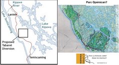

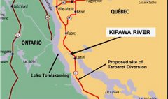


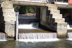


No comments:
Post a Comment